What draws you to the river? Maybe it is quiet sunrise paddles, summer picnics with friends, or the thrill of a walleye tugging the line. In Granite Falls, the Minnesota River shapes everyday life, from the way you spend weekends to the kind of home that fits your routine. If you are weighing a move or simply want to make the most of the outdoors, you will find clear guidance here. You will learn how the seasons flow, where to access the water, what to know about safety and rules, and how different home types support a river-first lifestyle. Let’s dive in.
Granite Falls and the Minnesota River
Granite Falls sits along the Minnesota River near its meeting with the Yellow Medicine River. The valley includes bluffs, floodplain, and riparian habitat that create scenic overlooks, wildlife viewing, and varied access points. These features influence where trails run, how you launch a kayak, and where you get a great view at sunset.
The river’s flow and banks change with the seasons. Spring snowmelt raises water levels and current. Summer brings warmer water and more boating opportunities. Fall color lights up the valley. Winter can quiet the landscape, but ice on a flowing river is unpredictable, so you should always check local conditions before heading out.
Climate and seasonal rhythm
You will experience four distinct seasons. That means different gear, different routines, and different safety checks. In spring, higher water can temporarily limit access to some ramps or low-lying trails. In summer, you can expect prime paddling and bank fishing days. Fall is excellent for hiking and birdwatching. In winter, rivers can have variable ice thickness due to current, so plan carefully and verify conditions.
Parks, trails, and getting to the water
City parks along the river typically offer picnic areas, playgrounds, scenic overlooks, and space for community events. You can plan a walk after dinner or meet friends for a casual afternoon by the water. Regional and local trails connect neighborhoods with the river corridor, and some routes follow the bluff lines for views.
For launching watercraft, the Minnesota Department of Natural Resources (DNR) maintains a statewide map of public boat ramps and shore access points. Use the DNR’s map of public water access sites to find ramp details, parking, and coordinates before you go.
- Check public ramps and shore access: DNR public water access map
Paddling day trips
Paddling the Minnesota River is all about matching your skill level to current conditions. Water depth, flow, and obstructions change with season and recent weather. Identify your put-in and take-out in advance, and confirm whether all access points are open. The DNR provides helpful planning resources for the Minnesota River water trail, including maps and considerations for different segments.
Trails and nature viewing
The river corridor supports birds, pollinators, and riparian vegetation. You can enjoy easy in-town walks or longer outings on regional routes. Paved sections are great for strollers and bikes, while natural-surface paths offer a more rustic experience. If you want a bigger day of hiking or birdwatching, explore DNR information on state parks and recreation areas to see what is nearby.
Recreation through the seasons
Living near the Minnesota River gives you new ways to mark time. Here is how the calendar typically looks.
Spring: High water and migrations
- Shoreline birding and river overlooks are lively during migration.
- Paddling is possible once ice clears, if conditions allow.
- Fishing often picks up after ice-out. Review current rules and season dates on DNR fishing regulations.
- High flow can close some access points. Check conditions before you go.
Summer: Peak water time
- Kayaking, canoeing, and motorized boating are popular where allowed. Always wear a life jacket and follow DNR boating safety guidance.
- Bank fishing is common along accessible stretches. The Minnesota River holds species such as walleye, channel catfish, northern pike, and panfish, depending on the reach. Confirm limits and seasons in the DNR fishing regulations.
- Prevent the spread of aquatic invasive species by cleaning and draining your boat and gear. Review DNR aquatic invasive species guidance before moving between waters.
Fall: Color and quiet water
- Cooler air and changing leaves make for great hiking and paddling days.
- Fishing continues with different patterns as water temperatures shift.
- Migrating waterfowl create excellent viewing opportunities. Give wildlife space, and follow posted rules in any designated areas.
Winter: Careful planning outdoors
- River ice is often less reliable than lake ice due to current. Always check thickness and safety recommendations. Start with the DNR’s ice safety guidelines and verify local conditions.
- Snowshoeing and cross-country skiing are great on maintained trails or open areas. Stick to permitted routes and respect private property.
Water quality and river health
The Minnesota River has stretches with elevated sediment and nutrient levels, which can affect water clarity and seasonal advisories. For a broad overview and updates on basin-wide efforts, review the Minnesota Pollution Control Agency’s information on the Minnesota River Basin. Before swimming or eating your catch, confirm current advisories with state resources.
Choosing a home that fits river life
The right property depends on how you want to use the river and how much maintenance you prefer. Here is how different options stack up.
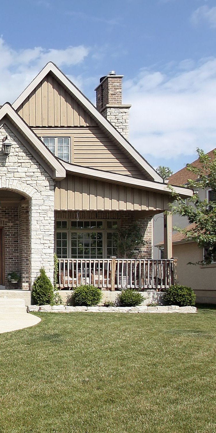
River-adjacent homes
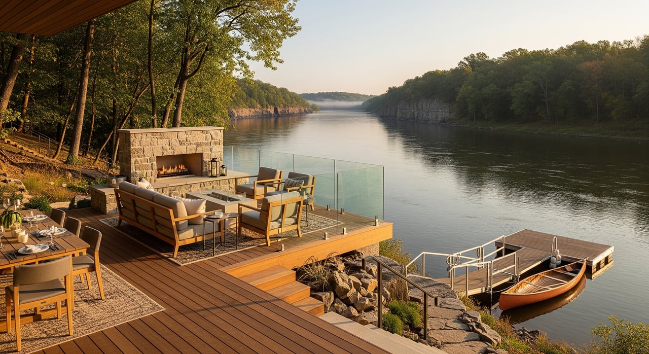
If you want the water steps from your door, riverfront or river-view homes deliver an immersive experience. You can stage kayaks more easily and enjoy morning coffee with a view. That convenience comes with extra due diligence.
- Flood risk. Many river lots sit in FEMA-designated floodplains or floodways. Review the FEMA Flood Map Service Center for the specific parcel and ask for an elevation certificate.
- Insurance. Your lender may require flood insurance in certain zones. Learn the basics through the National Flood Insurance Program at FloodSmart.
- Shoreline rules. Docks, riprap, and vegetation changes often require permits. Minnesota shoreland rules and county ordinances guide what is allowed. Plan ahead and keep documentation.
- Bank stability. Erosion control and riparian protections may restrict modifications to the shoreline.
In-town single-family homes
If you want easy access without the complexities of direct shoreline, in-town homes near parks can be ideal. You can walk to river overlooks, playgrounds, and trails, and you will likely have municipal utilities. Shoreland overlay rules may still apply depending on distance to the river, so verify setbacks and permits if you plan to build or expand.
Rural river properties and acreage
Acreage along tributaries or near the river offers room to roam, privacy, and space for gear like boats or RVs. Expect to manage a well and septic system, and consider winter road access. Boat ramps and emergency services may be farther away, so plan travel times for busy weekends or snowy days. Check county environmental services for septic compliance and permitting.
Safety, permits, and practical steps
Before you buy, sell, or make changes to a river-area property, run through this checklist. It will save time and reduce surprises.
- Confirm flood zones. Look up the parcel on the FEMA Flood Map Service Center and ask for the current elevation certificate.
- Understand insurance. If your property sits in a higher-risk zone, review coverage options through FloodSmart.
- Verify shoreline permissions. Many modifications require permits from state or county offices. Gather approvals before you start work.
- Check public access. Identify your closest boat ramps and shore fishing spots with the DNR public water access map.
- Review fishing rules. If you plan to angle, read the latest DNR fishing regulations for seasons, limits, and special rules.
- Prevent invasives. Clean, drain, and dry watercraft per DNR aquatic invasive species guidance.
- Watch conditions. Use the DNR’s ice safety guidelines in winter and follow posted advisories during spring high water.
- Learn the river. For route planning and segment details, consult the Minnesota River water trail.
- Check water quality context. For basin-wide information, see the MPCA’s Minnesota River Basin resources.
Make the most of Granite Falls river life
Outdoor living in Granite Falls is a lifestyle choice that pays you back every season. With the right plan, you can enjoy paddling mornings, park afternoons, and quiet evenings on the overlook, all while staying on top of safety and local rules. If you are exploring river-adjacent, in-town, or acreage options, you deserve a clear path forward from search to closing.
You can lean on local expertise to weigh flood maps, shoreland rules, utilities, and access before you make a decision. For patient guidance and neighborhood-level insight across Southwest Minnesota, connect with Cynthia Rogers. Let’s move forward, together.
FAQs
What outdoor activities are popular on the Minnesota River in Granite Falls?
- Paddling, boating where allowed, bank fishing, birdwatching, picnicking at riverfront parks, and hiking nearby trails are common. Always follow DNR boating safety guidance and check access conditions.
Where can you launch a kayak or boat near Granite Falls?
- Use the DNR public water access map to find ramps and shore access points, then verify parking and current river levels before you go.
How safe is winter ice on the Minnesota River?
- River ice is less predictable than lake ice because of current. Start with the DNR’s ice safety guidelines and confirm local conditions before stepping out.
Do you need flood insurance for a riverfront home in Granite Falls?
- It depends on the FEMA flood zone for your parcel and lender requirements. Check your address on the FEMA Flood Map Service Center and review coverage at FloodSmart.
What fishing rules apply on the Minnesota River near Granite Falls?
- You must have a valid license and follow seasons, limits, and any segment-specific rules. Review current DNR fishing regulations before you fish.
Are shoreline changes allowed on private property along the river?
- Many alterations, including docks, riprap, and vegetation removal, require permits under state shoreland rules and county ordinances. Contact local permitting offices and plan to follow DNR guidance on shoreline work.